Best Stops Along the Icefields Parkway (Complete Guide & Map)
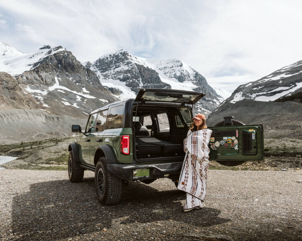
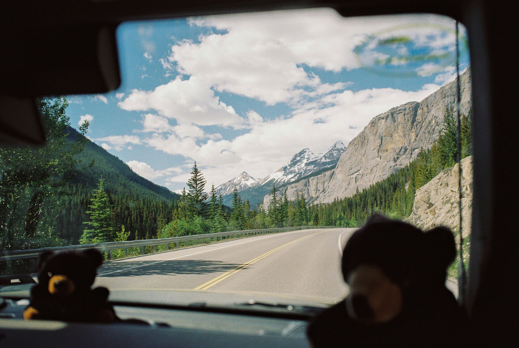
There aren’t many roads worth being sentimental about, but the Icefields Parkway is one we find ourselves thinking about often. We still remember the excitement of driving it for the first time. It wasn’t long after we moved to Canada, and we felt as if we had just stepped inside a nature documentary (minus the voice-over by David Attenborough). Now, after driving it many times, we can safely say no trip to the Canadian Rockies feels complete without the Icefields Parkway.
The Icefields Parkway winds its way through two of Canada’s most spectacular national parks, Banff and Jasper. Google Maps says the drive takes just under three hours, but that’s only if you don’t stop, which you will. A turquoise lake appears in front of you and you stop. A waterfall tumbles down a mountainside and you stop. A chance to walk on an ancient glacier and, of course, you stop. By the time you reach Jasper, the sun is setting and you’re wondering how it happened so fast.
The best thing about driving the Icefields Parkway is that you can enjoy the sights however you want. You can stay in the car and soak it all in through the window. Or get out and hike. Or do a bit of both. The point is, there’s no wrong way to do it. You’re guaranteed to see something amazing no matter what.
In this guide, we’ll share our best tips for driving the Icefields Parkway, all based on our own trips. We’ll cover where to stop for the best views and what we wish we’d known before our first drive.
What is the Icefields Parkway?
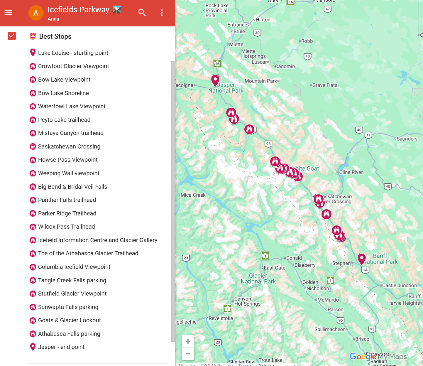
The Icefields Parkway is officially Alberta’s Highway 93 North. It connects the hamlet of Lake Louise with the town of Jasper, spanning 232 kilometers through the heart of the Canadian Rockies.
Best stops along the Icefields Parkway
We have listed the must-see spots on the Icefields Parkway in order from Lake Louise to Jasper, which is the direction most people travel.
Crowfoot Glacier Viewpoint
🏞️ Category: Viewpoint
⌛Time needed: 10 mins
🦍💨 Washrooms: No
Your first stop is a small pull-off where you can see Crowfoot Glacier hanging on the side of the mountain overlooking Bow Lake. It got its name because it used to look like a crow’s foot, with three prominent toes. It has retreated significantly over the years and the ‘foot’ is now down to about one and a half toes. You’ll see more glaciers as you drive, and later at the Columbia Icefield, you’ll get an even clearer picture of how much they’ve retreated by standing where the glacier used to be 100 years ago.
Bow Lake Viewpoint
🏞️ Category: Viewpoint
⌛Time needed: 15 mins
🦍💨 Washrooms: In the public day-use parking lot next to Bow Lake
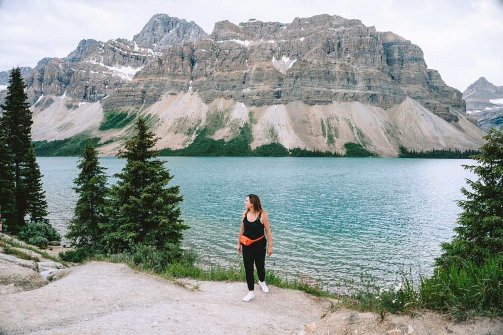
This is the first lake where you’ll have that wow moment. Bow Lake is stunningly beautiful, with the vivid blue colour of the water and glaciated mountains rising all around it.
Every time we stop here, we see someone taking a dip in the icy water. It’s not something we recommend you do unless you’re into cold plunges and feeling adventurous. We’re just mentioning it because swimming in glacial lakes is a classic Canadian experience and it looks like some visitors clearly think it’s a good lake for it.
The main viewpoint is right along the parkway and there’re always a lot of people here taking photos. If you like the look of the lake and want to see more viewpoints, there’s a small parking lot next to the Bow Lake Lodge on the shore, and another overflow lot closer to the turnoff to the parkway, with a walking trail that leads to the shore. Inside the lodge, there’s a cafe and a gallery, and outside you’ll find picnic benches.
The shoreline of Bow Lake is a popular place for morning photography, as it’s often not windy, creating mirror-like reflections and beautiful sunrise colours.
If you want to hike, Bow Glacier Falls is the most popular trail (time needed: 2-4 hours). You can also see the waterfall from the shore of the lake, though it’s not quite the same.
Waterfowl Lakes
🏞️ Category: Viewpoint
⌛Time needed: 10 mins
🦍💨 Washrooms: No
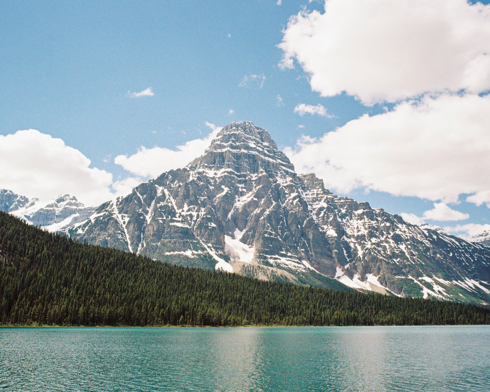
Waterfowl Lakes consist of two beautiful alpine lakes with Mount Chephren rising dramatically on the far side. Mount Chephren is easy to spot because its distinctive pointed peak dominates the view.
There are a couple of viewpoints here and the parking lot provides good access. Even from the car, the view is stunning. But the green and blue tones of the lakes are worth a proper stop.
Peyto Lake
🏞️ Category: Lake viewpoint
⌛Time needed: 1-2 hours
🦍💨 Washrooms: Yes
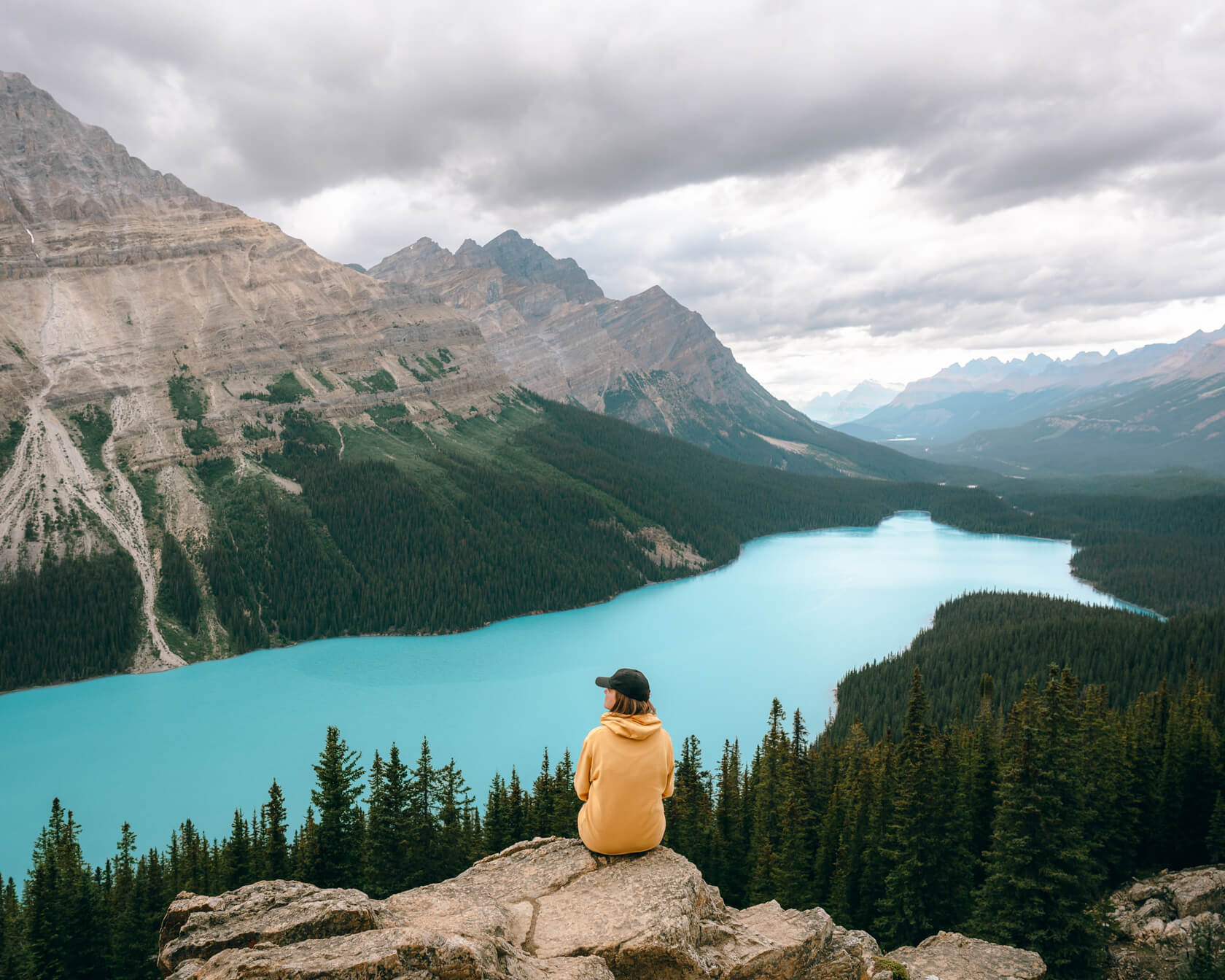
You’ve probably seen photos of this lake many times when planning your trip, as it’s one of the most popular lakes to visit in the Rockies. And once you see how intensely blue the water is, you’ll instantly understand the hype.
Why is Peyto Lake so blue?
Peyto Lake is fed by Peyto Glacier, which gives it its unique blue hue. As the glacier moves, it grinds the rocks beneath it into a fine powder called rock flour or silt. Meltwater carries this silt into the lake. When sunlight hits the suspended particles, it scatters all colours except green and blue, which reflect back to your eye. The result is that intense blue colour that makes you want to stare at it for hours. To see the colour at its peak, July and August are best.
There is a viewing platform at Bow Summit with a beautiful panorama of the lake, its surrounding peaks and the Peyto Glacier. What’s really cool is that the platform sits at 2,088 metres (6,850 feet). One of the highest accessible viewpoints in all of Canada!
The platform is about a 10-15 minute walk from the parking lot, with some elevation gain and loss, but the trail is well-maintained and accessible for most people, including wheelchair users.
It’s also very busy in summer with lots of tour buses coming and going all day.
But here’s a secret … there’s another viewpoint tucked away from the crowds. The trail that leads there is unmarked and has several confusing turns, but finding the right path is part of the fun. We definitely enjoyed having this viewpoint to ourselves for a few minutes and taking photos far better than from the main viewing platform.
If you’d prefer this quieter experience but only have one day for the Icefields Parkway, we recommend visiting Peyto Lake on its own on another day. This will be easy enough to do if you’re staying for a few days in Banff, Canmore, Lake Louise or Golden and doing something else nearby, eg visiting Lake Louise or Moraine Lake. You can then skip Peyto Lake on the day you drive the parkway, leaving you time for other things.
Fun fact: The lake is said to be shaped like a wolf’s head. I don’t really see it, but your imagination might work better than mine on this one.
Mistaya Canyon
🏞️ Category: Out and back hike
⌛Time needed: 30 mins to 1 hour
🦍💨 Washrooms: Yes (pit toilets)
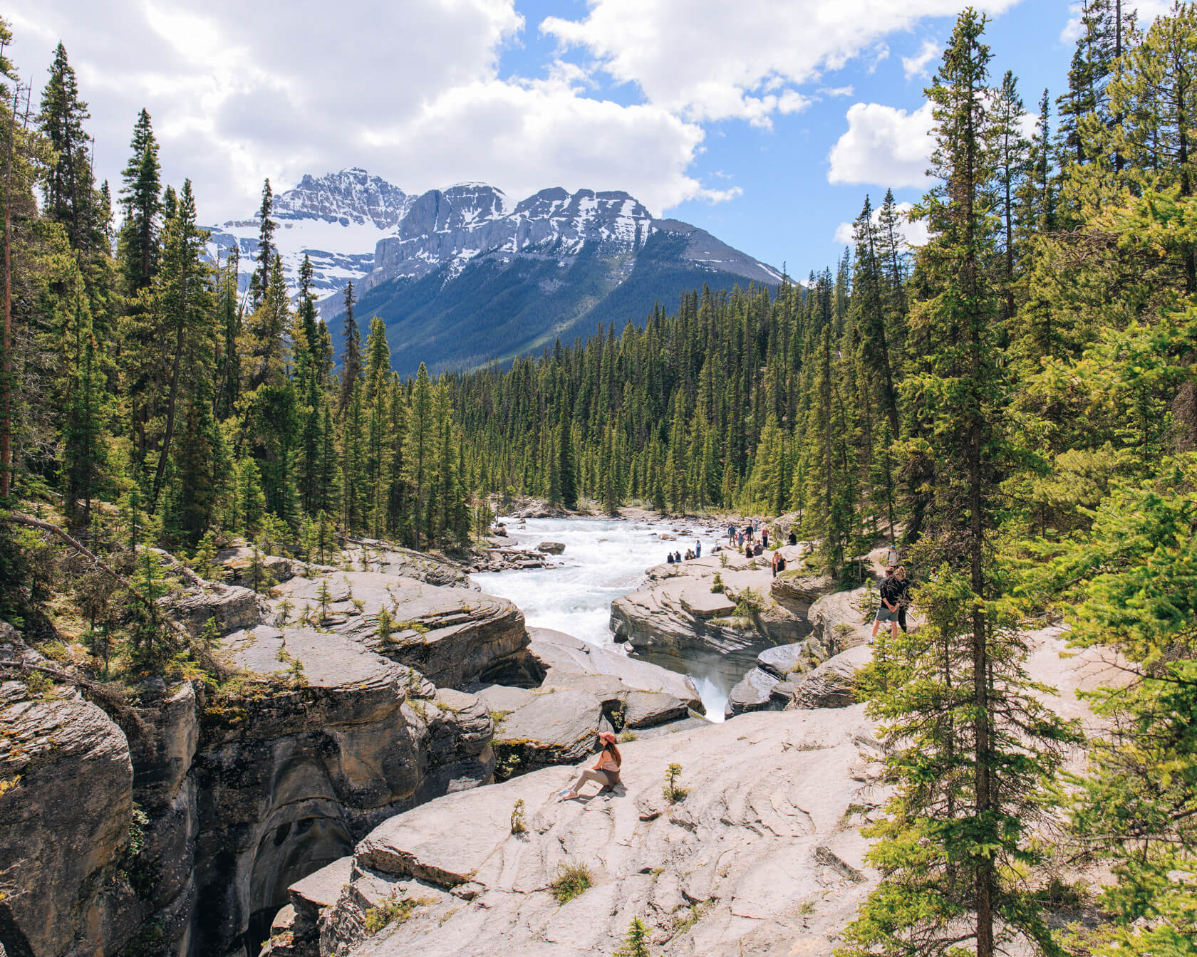
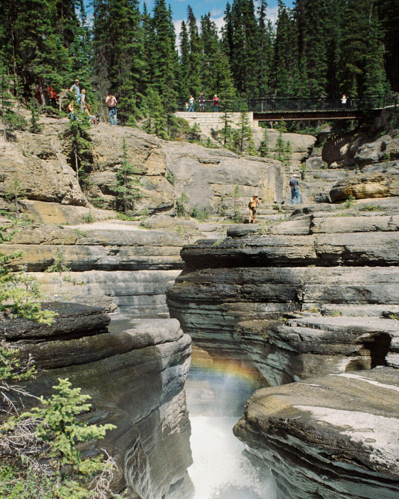
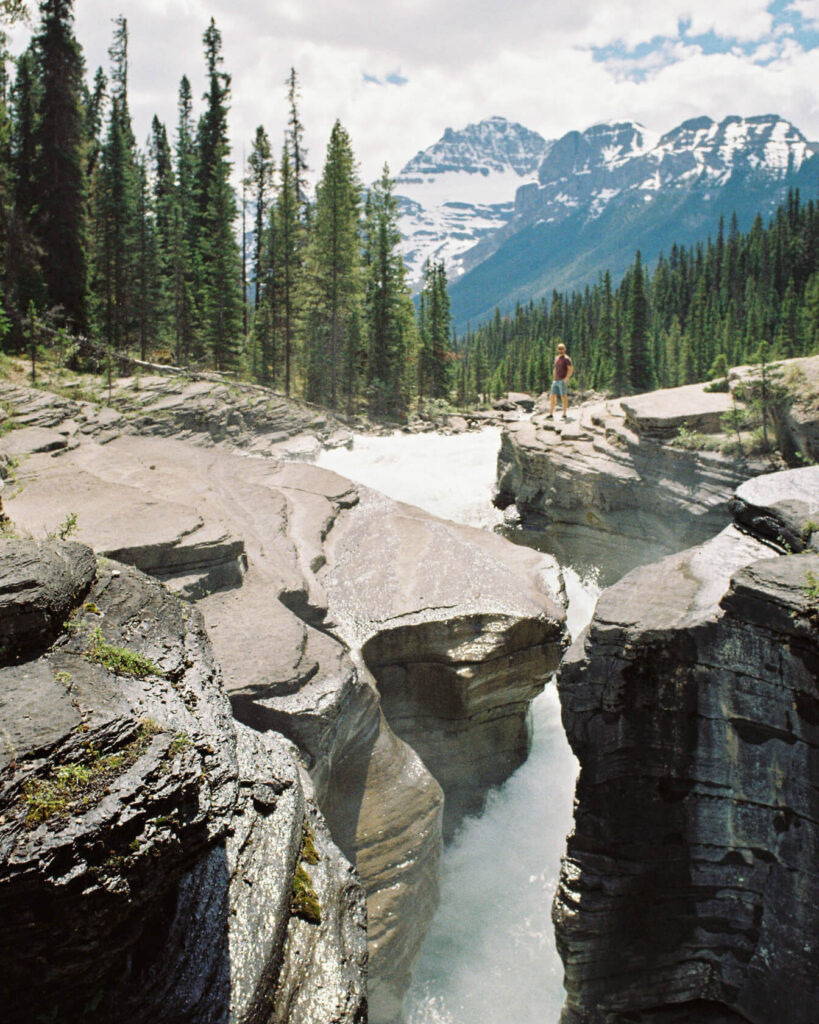
Mistaya Canyon is hands down one of the most impressive sights along the Icefields Parkway. The Mistaya River that flows through here originates from Peyto Lake (the same turquoise lake you just saw), and by the time it reaches the canyon, it’s got some serious power.
For thousands of years, the river has carved through limestone, creating a narrow gorge with swirling walls and deep potholes.
In summer, it’s more of a walk than a hike, around 15 minutes of easy walking one way. That said, there is some elevation on the way back (around 80m if you go all the way down to the river).
The first viewpoint is the wooden bridge spanning the canyon and it’s where most people stop. But you should go further. You can stand right on the edge of the gorge and even climb down to the river to get a better look at the carved rock and layers of limestone. If you look in the other direction, you’ll see Mount Sarbach in the distance.
What’s great is how much jaw-dropping scenery you get for so little effort. Mistaya Canyon is unlike anything else on the route and a must-see in our book.
Howse Pass
🏞️ Category: viewpoint (not visible from the parkway)
⌛Time needed: 10-20 minutes
🦍💨 Washrooms: Yes
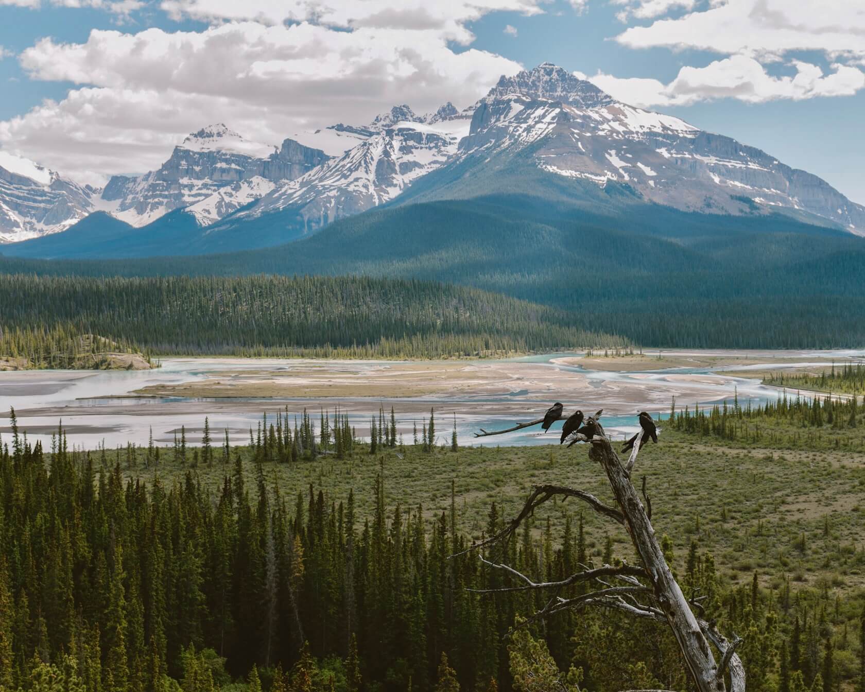
Down a little path hidden behind the trees is a gorgeous panoramic view of the North Saskatchewan River and the Howse Valley. The first thing you’ll notice is the beautiful milky color of the water. To your left will be Mt. Sarbach, which you saw from Mistaya Canyon, Mt. Forbes in the center and Survey Peak on the right.
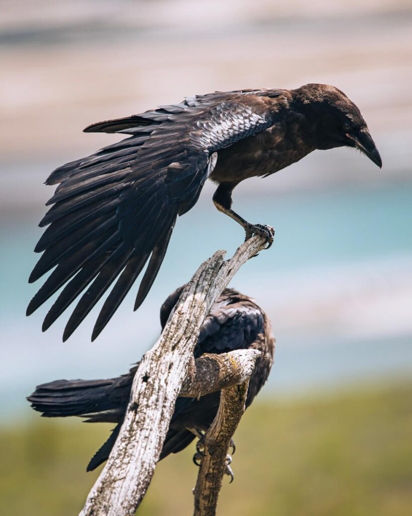
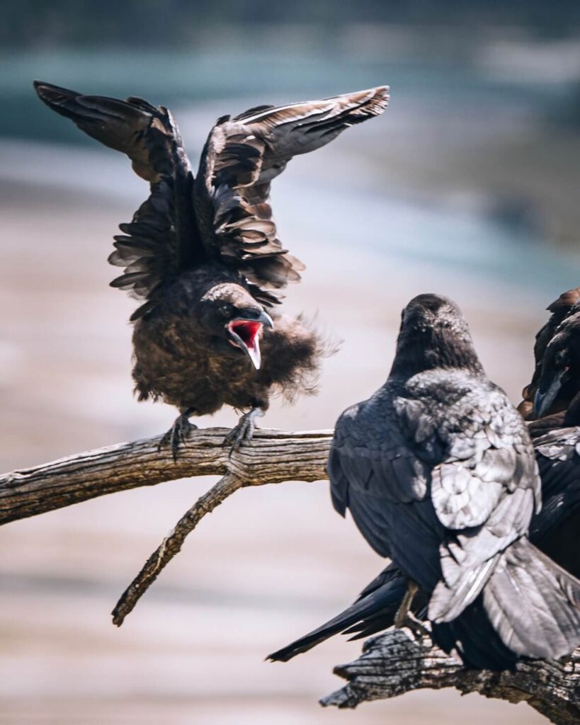
Last summer, we stumbled upon a really cool scene: a family of ravens perched on a dead tree by the viewpoint, parents feeding their nearly grown chicks. There was so much noise and commotion that we spent way more time here than planned just photographing the interactions.
This whole valley is a corridor for wildlife moving between habitats, so you might sometimes spot wildlife in the distance as it moves through. We read that you can often hear wolves in the evening, but we haven’t been lucky to experience that ourselves.
Saskatchewan Crossing (optional)
🏞️ Category: Pit-stop
⌛Time needed: 10 mins
🦍💨 Washrooms: Yes
This is where the three rivers of the Saskatchewan, Mistaya and Howse meet to form the North Saskatchewan River.
Indigenous peoples have used this river valley for thousands of years for hunting and fishing, and later it became a key fur trade route. Today, it’s just a practical pit stop, albeit with beautiful views.
It’s the only fuel stop along the parkway. But the prices are A LOT higher than in Lake Louise or Jasper. That’s to be expected since it’s so remote, but it’s why you should fill up in Lake Louise.
There’s also a small convenience store, cafe and a civilized washroom. If you’re exploring in an RV, they have sani dump services and potable water. There’s also a souvenir store if you’re the type who likes to bring home a fridge magnet from every place you visit.
There’s a hotel on site if you want to break up the drive. We never stayed here, but it’s an option.
Weeping Wall, Big Bend, Bridal Veil Falls and Panther Falls
🏞️ Category: Viewpoint
⌛Time needed: 10-20 minutes (more if you hike to Panther Falls)
🦍💨 Washrooms: No
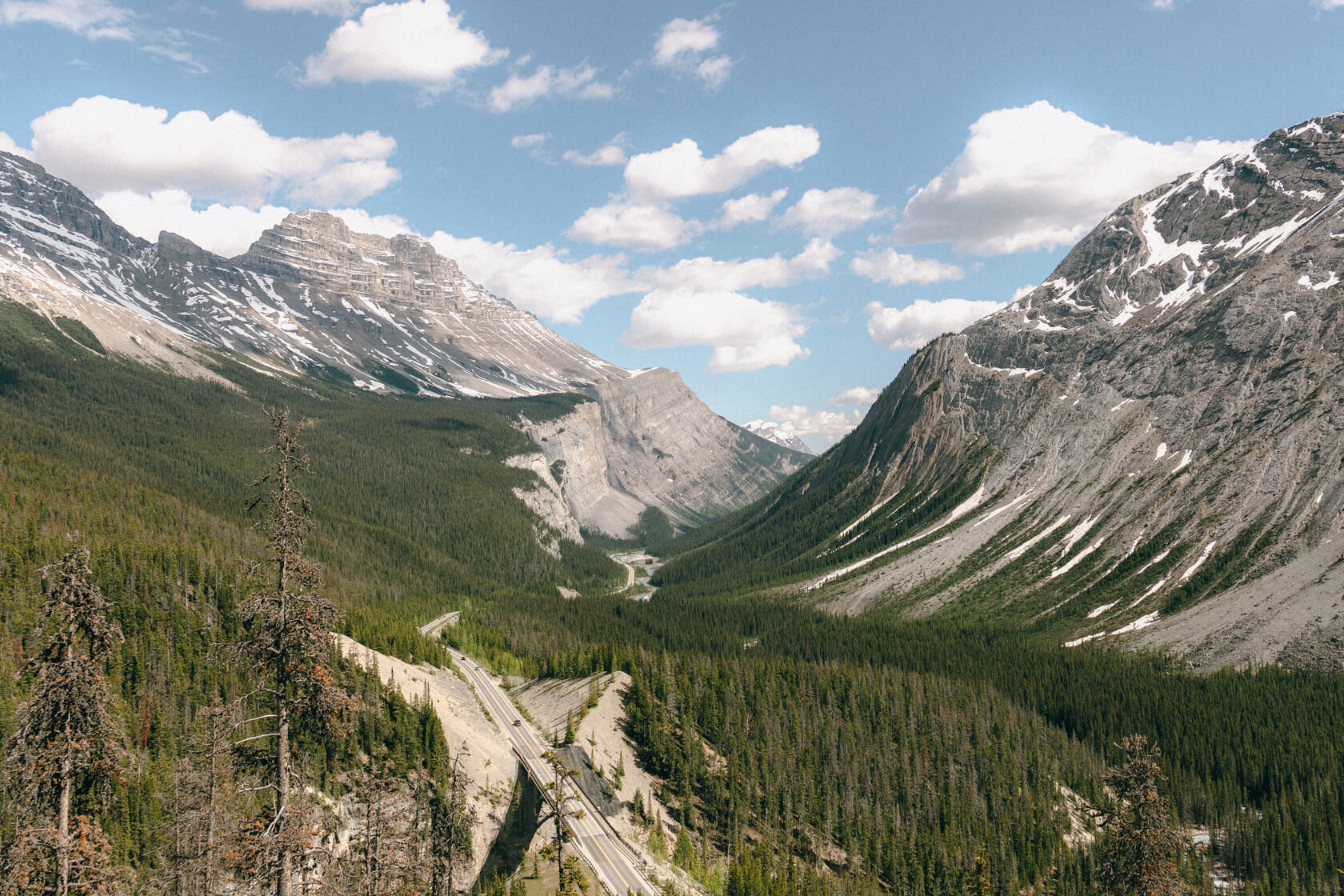
The Weeping Wall is a dramatic curtain of waterfalls cascading down the limestone face of Cirrus Mountain. It lives up to its name only for a couple of months each year during spring snowmelt (May and June). Come winter, the streams freeze into pillars of ice, transforming the Weeping Wall into one of the most famous ice climbs in the entire world.
Right after the Weeping Wall, the road starts climbing and makes a huge switchback known as the Big Bend. There’s a pullout on the right where you can stop and look back at the Icefields Parkway snaking through the valley below.
To your left, you’ll see a slender ribbon of Bridal Veil Falls pouring down the mountain on the opposite side of the valley. There is another pullout further down the parkway, where you can get a closer look at these falls (watch out for it, it’s easy to miss). But there’s another waterfall here that’s less known, as it’s hidden from view and the trailhead isn’t obvious. It’s called Panther Falls, and you can reach it with a short hike (0.8km one way) through the forest. The spray will soak you if you get close, but that’s part of the fun.
Parker Ridge
🏞️ Category: Hike
🥾Stats: 6.5km return, 281m elevation gain
⌛Time needed: 2 – 4 hours
🦍💨 Washrooms: Yes (pit toilets)
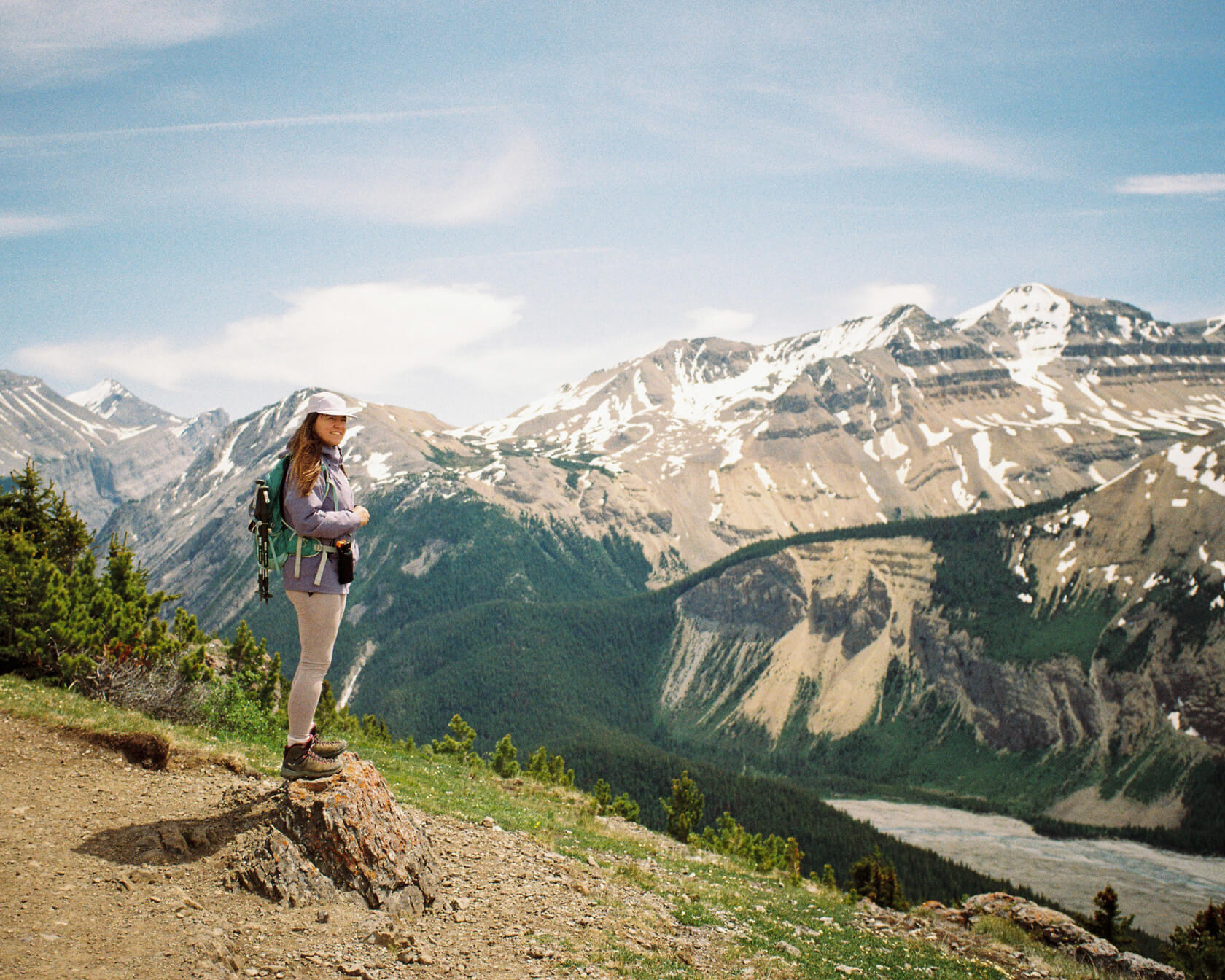
This is a great hike that is doable for most hikers, as it’s not technical at all. We saw people of all ages here, from kids to grandparents.
The trail is a narrow path with many switchbacks, climbing steadily through the forest at first and then later above the treeline, with fantastic views of the parkway and the surrounding mountains. But the best part is at the top of the ridge: a breathtaking panoramic view of the Saskatchewan Glacier, the longest glacier tongue in the Rockies. To see the glacier, you need to keep to the left at the top of the ridge. You’ll see another path leading to the right for a different view, but that’s an optional adventure.
At the very end of the trail, you’ll see a sign that says you can’t go any further. We hadn’t seen a sign like that before, and it stood out to us, especially since there’s nowhere else to go from there.
We also saw two bighorn sheep on this hike. There are no guarantees they’ll be there when you visit, of course. Wildlife does its own thing, but there’s a chance.
All in all, our moving time as moderate hikers was 1:55 h, but our total time was 3 hours as we spent so much time admiring the views and taking photos.
Aim for this hike in summer and on clear days. Bring sturdy shoes and be ready for anything. The trail surprised us with snow in July (though we should have expected it at this elevation), mud underfoot, and gusty winds at the summit.
Wilcox Ridge
🏞️ Category: Hike
🥾Stats to Parks Canada red chairs: 3.2 km return, 170m elevation gain
🥾 Stats to Wilcox Ridge: 10.6 km return, 528 m elevation gain
⌛Time needed: 1.5 – 5 hours (see below)
🦍💨 Washrooms: Yes (pit toilets)
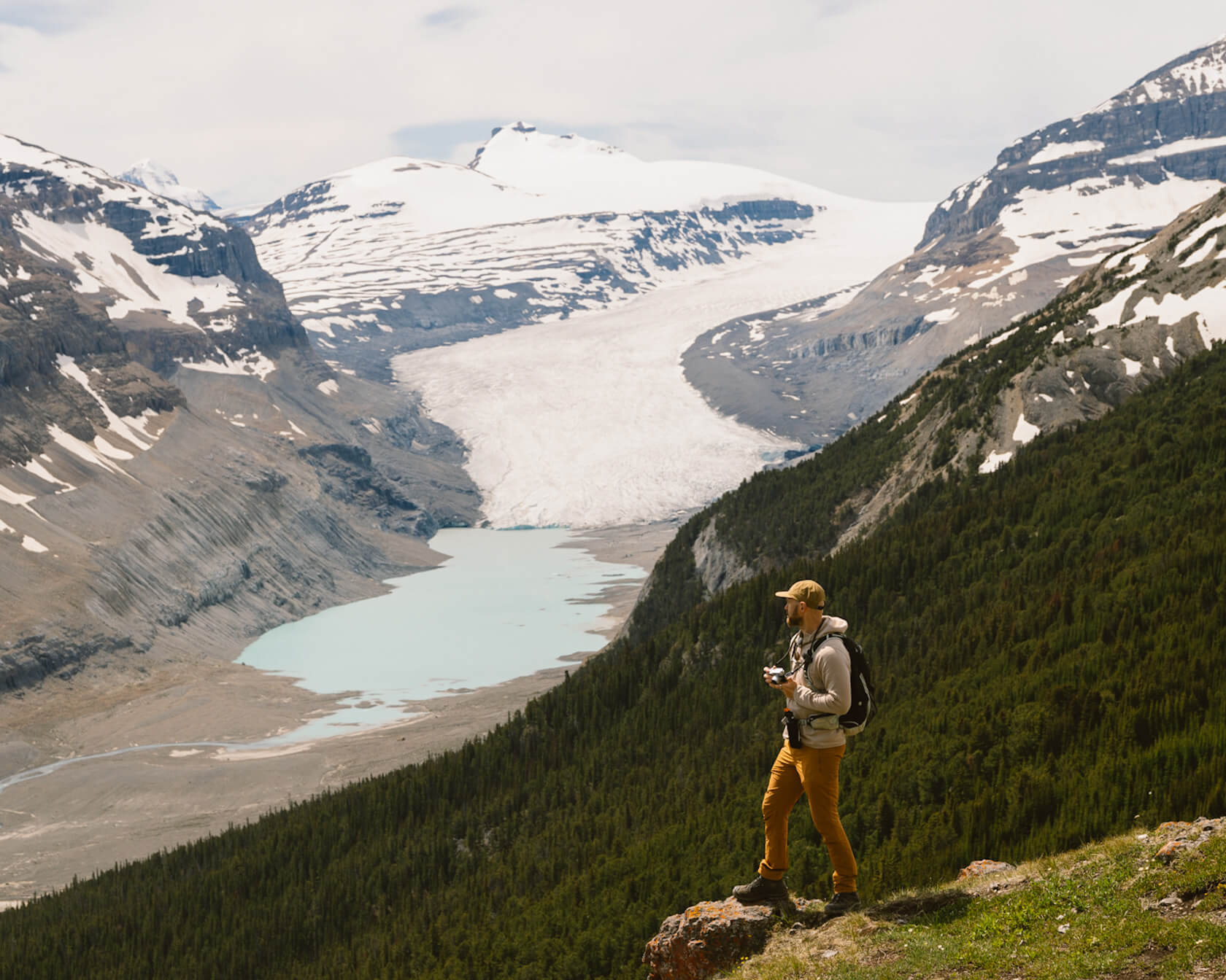
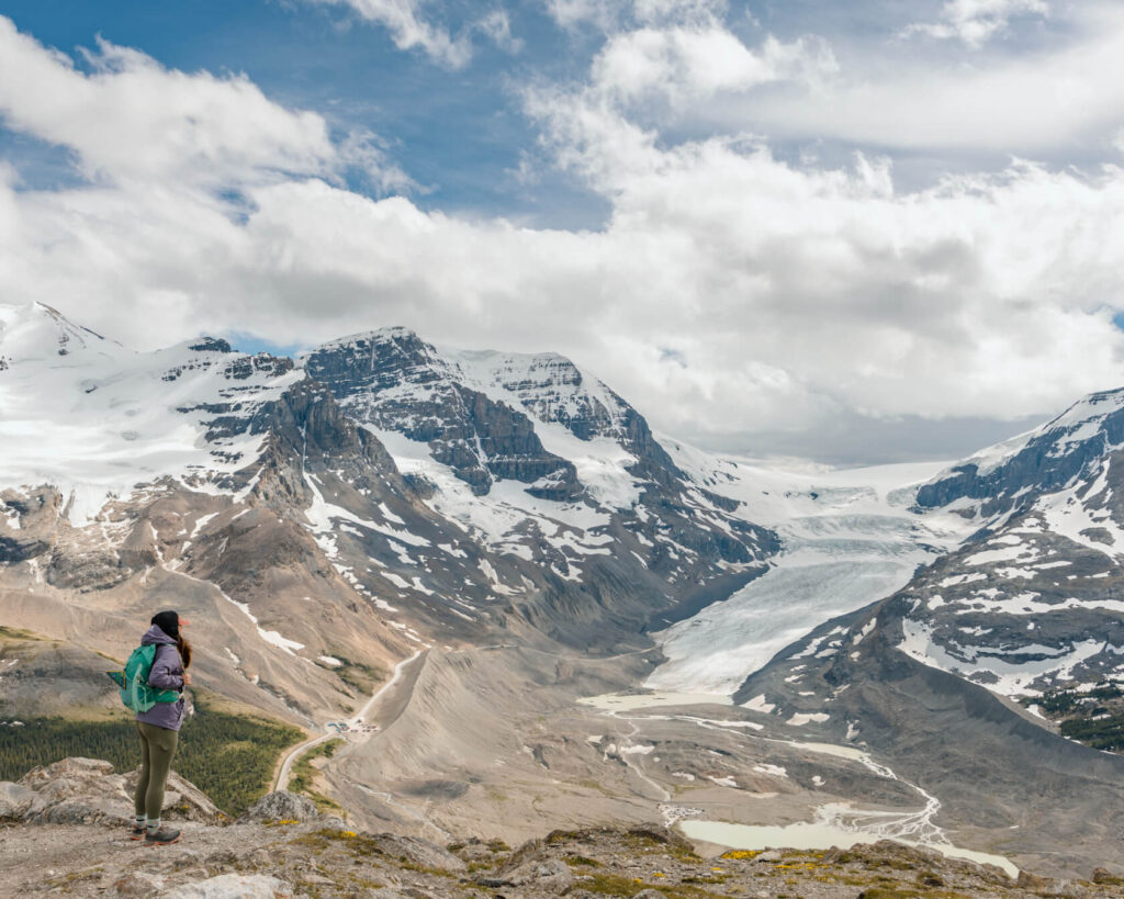
Wilcox Ridge is another great hike on the parkway. It gives you views of the Athabasca Glacier from above rather than from the valley, which most people driving the parkway don’t experience.
There are three ways to do this hike.
The first option is to hike to the pair of red Parks Canada Adirondack chairs. This section is straightforward as far as hiking goes, which is great as it allows people of different abilities to experience the amazing view. That said, you’re in the mountains and you should be prepared for any eventuality. There is 170m of elevation gain, but over a relatively short distance of 1.8km.
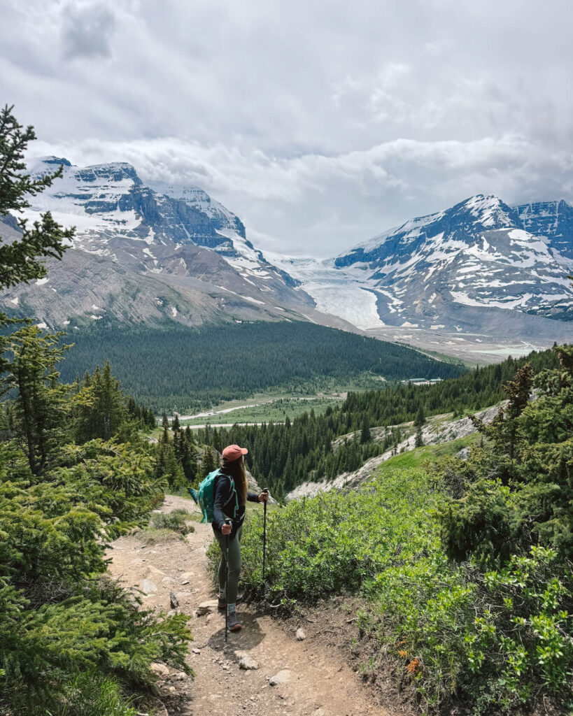
View towards the Icefields Parkway and Athabasca Galcier 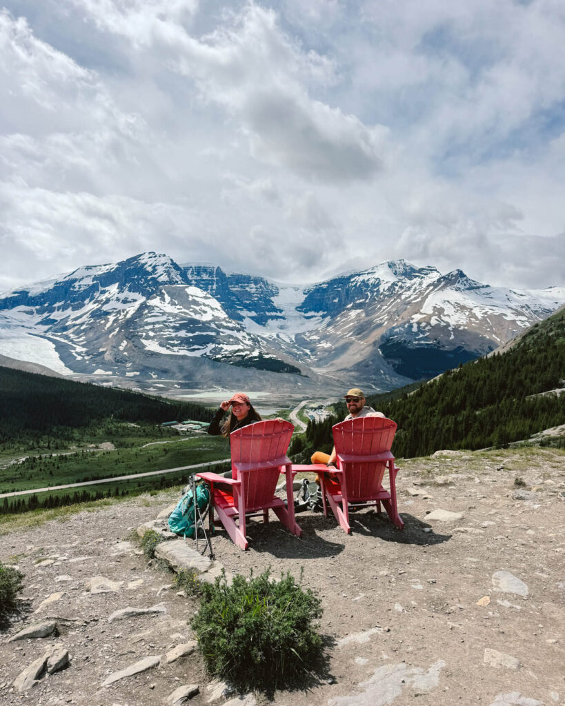
Parks Canada Adirondack chairs
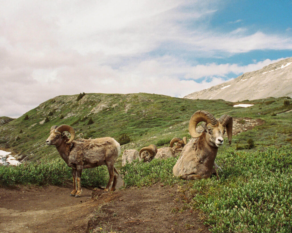
You can continue exploring Wilcox Pass for more views and a chance to see bighorn sheep. We probably wouldn’t recommend going too far if you’re not continuing to the ridge, unless you really want to try for sheep, which are often seen on this trail but never guaranteed since they’re wild animals and do their own thing.
If you decide to push on past Wilcox Pass to Wilcox Ridge, you’ll be rewarded with a mind-blowing view. You’ll see not only the Athabasca Glacier but also the Andromeda Glacier and the Dome Glacier. Being up high and standing opposite them with the Icefields Parkway in between is a great feeling. This is a proper hike but with no technical sections. Even in summer, expect some mud and snow on the trail and wind at the top, especially at the viewpoint. Don’t underestimate how cold it gets here. These winds come from the Athabasca Glacier and you won’t last long without a windproof jacket.
Our moving time as moderate hikers was 3 hours, but we spent 4.5 hours on the trail because we stopped a lot for photos. If you don’t have time or aren’t into longer hikes, the red chairs option is fantastic on its own.
The Columbia Icefield, Icefield Centre and the Athabasca Glacier
🏞️ Category: Various options (see below)
⌛Time needed: Various options (see below)
🦍💨 Washrooms: Yes
The Columbia Icefield is one of Canada’s most extraordinary natural wonders. It’s one of the last remnants of the thick ice mass that once covered most of the Canadian Rockies. Perched high in the mountains, it survives thanks to frigid temperatures and heavy snowfall. From the main body of the ice cap, six glaciers flow down the surrounding valleys. Of these glaciers, the most popular and most accessible is the Athabasca Glacier.
You can see the Athabasca Glacier from the parkway, but the wild part is that it used to be where the parkway now runs just over 100 years ago. Because of a warming climate, it has been shrinking and melting fast, leaving behind a moonscape-like rocky moraine. A 100 years may seem like a long time, but on a geological scale, it’s basically yesterday.
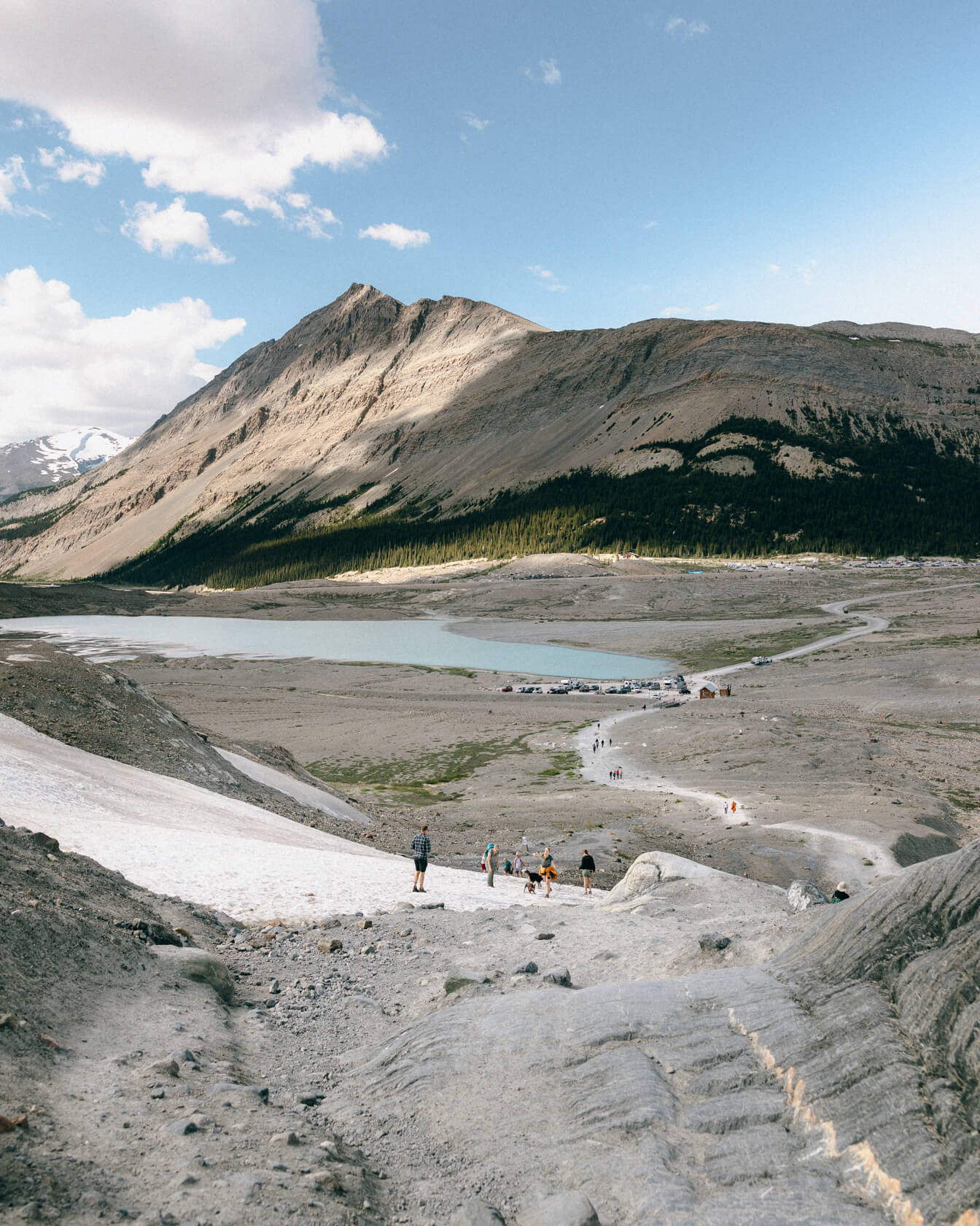
Toe of the glacier hike – looking back towards parking lot 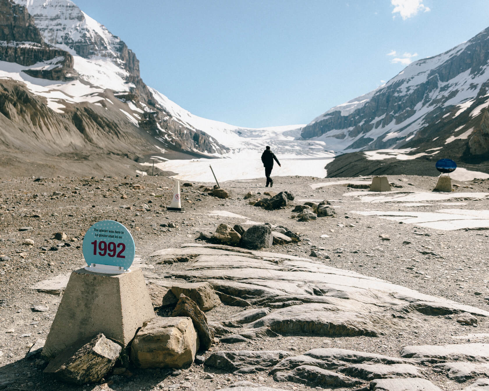
Information plaque shtanding where the glacier used to be 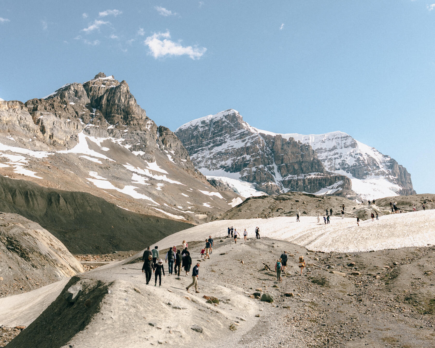
Toe of the Athabasca Glacier hike 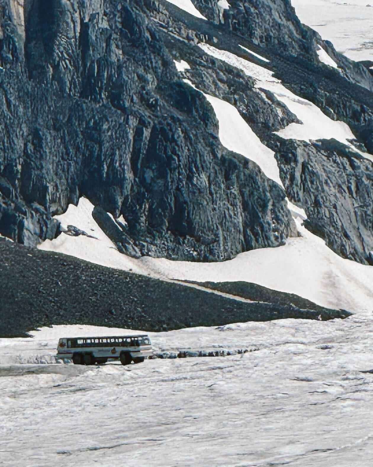
Ice Explorer bus
How Can You See the Athabasca Glacier?
You can’t walk on the glacier alone for safety reasons, so here are your options:
- Ice Explorer Tour – travel to the glacier in a special bus designed for glacier travel with balloon tires measuring over 5′ high and walk on the surface of the glacier. Book now!
- Go on a guided hike and walk on the surface of the glacier. Book now!
- Visit the Glacier Gallery inside the Icefield Centre to learn about glacier formation and movement and see a scaled-down fibreglass model of the Athabasca Glacier. Free!
- Columbia Icefield Skywalk Tour – test your fear of heights on the glass-floored skywalk. Book here!
- Hike to the Toe of the Athabasca Glacier. Free!
Having already walked on a glacier before, we opted for the Toe of the Athabasca Glacier hike. It’s a short 1.4 km trail, but you’ll be hiking on uneven terrain, may have to cross a snowy section (even in summer), and there are a couple of steep sections. We saw people of all ages tackling it. Along the way are signs marking previous locations of the receding Athabasca’s toe, which is a little disheartening but a great way to visualize how much the glacier has receded. If you have time, don’t miss this walk.
If you haven’t walked on a glacier before, consider joining a guided hike or doing the Ice Explorer tour we linked above. Whichever you choose, this is a must-see stop. Especially given how fast glaciers are melting worldwide.
If you’d like to stay overnight and take your time exploring the Columbia Icefield, you can stay at the beautiful Glacier View Lodge.
Sunwapta Falls
🏞️ Category: Waterfall
⌛Time needed: 15-20 minutes (more if you hike to lower Sunwapta Falls)
🦍💨 Washrooms: Yes (pit-toilet)
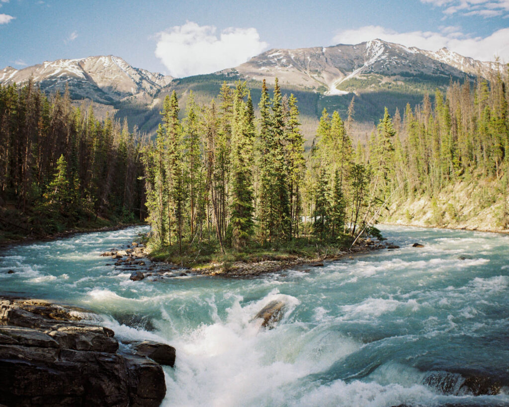
Sunwapta Falls is gorgeous. Its name, from the Stoney Nakoda language, means turbulent water. You’ll understand why when you see this powerful torrent of water plunge about 18 metres into a deep gorge the Sunwapta River has carved over thousands of years. The river carries meltwater from the Athabasca Glacier, so the colour upstream is milky blue. A small forested island then splits the flow just above the edge of the falls, and the water transforms into a wild, frothy cascade.
The upper Sunwapta Falls are an easy short walk from the parking lot, so they’re accessible for pretty much everyone. If you have time, it’s worth hiking down to the lower Sunwapta Falls as well. It’s a gradual downhill hike to a series of viewpoints that are much more secluded and far from the crowds.
But if you’re trying to fit in as much as possible in one day, stop only at the upper falls as there’s another waterfall closer to Jasper, Athabasca Falls, that you’ll want to see as well.
It can get crowded depending on the time of day and parking can be an issue.
Tangle Creek Falls and Stutfield Glacier
🏞️ Category: Waterfall
⌛Time needed: 5-10 minutes (more if you want to climb to the top)
🦍💨 Washrooms: Yes (pit toilet)
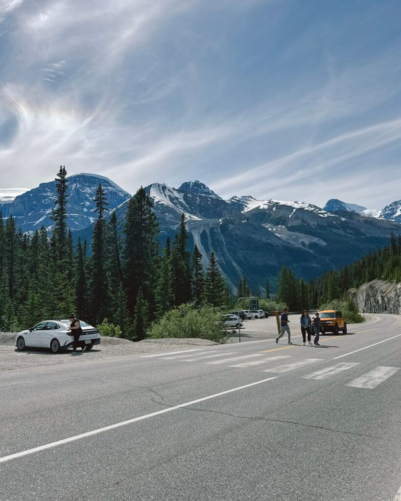
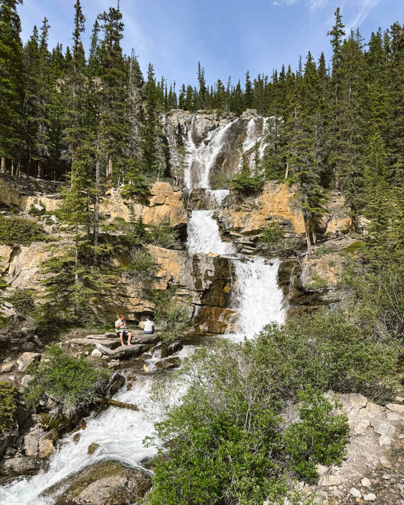
Tangle Creek Falls is right on the edge of the parkway, literally metres away, so the parking lot is on the opposite side. It consists of a lot of small rivulets rather than one powerful cascade, so it’s quite delicate in appearance. That may be where the name ‘Tangle Creek’ comes from. The water flows down a series of rocky tiers, creating a nice, layered effect.
There’s just one viewpoint on the edge of the highway, but many people climb up to the top of the falls for a different perspective. That means it’s tricky to photograph without people in your frame if you’re into photography, but nothing Photoshop can’t fix.
It’s worth stopping here not just for the waterfall, but also because the parking lot doubles as a viewpoint of the Stutfield Glacier, one of the six glaciers flowing from the Columbia Icefield. If you’re lucky, you might even spot mountain goats scrambling nearby.
Goats & Glacier Lookout
🏞️ Category: Viewpoint
⌛Time needed: 5-10 minutes
🦍💨 Washrooms: Yes (pit toilet)
This viewpoint sits on the edge of a cliff and offers a sweeping panorama of the Athabasca River valley with snowy peaks all around. The water is milky blue most of the summer since it’s fed by glaciers. Sometimes the colour disappears temporarily after heavy rain, but it always returns.
Mountain goats often visit to lick salt from the rocks, but even though the viewpoint is named after them, they aren’t always around. It’s best to visit without expectations and enjoy the surprise if you do see them. We missed the goats, but spotted a moose in the distance, which was a delightful bonus!
You can see the view from the parking area, but there’s also a short path that leads to a viewing platform.
Athabasca Falls
🏞️ Category: Waterfall
⌛Time needed: 20 minutes (more if you hike the lower canyon trail)
🦍💨 Washrooms: Yes (pit toilet)
Athabasca Falls is situated on the Athabasca River and plummets over 20 meters into a narrow canyon. It’s the most powerful waterfall you will see along the Icefields Parkway. Not because of its height but because of its volume, especially during spring snowmelt. The flow is so strong that the air around the waterfall is filled with mist. If you’re lucky and visit under the right conditions, you can often see a rainbow that forms when sunlight passes through the droplets.
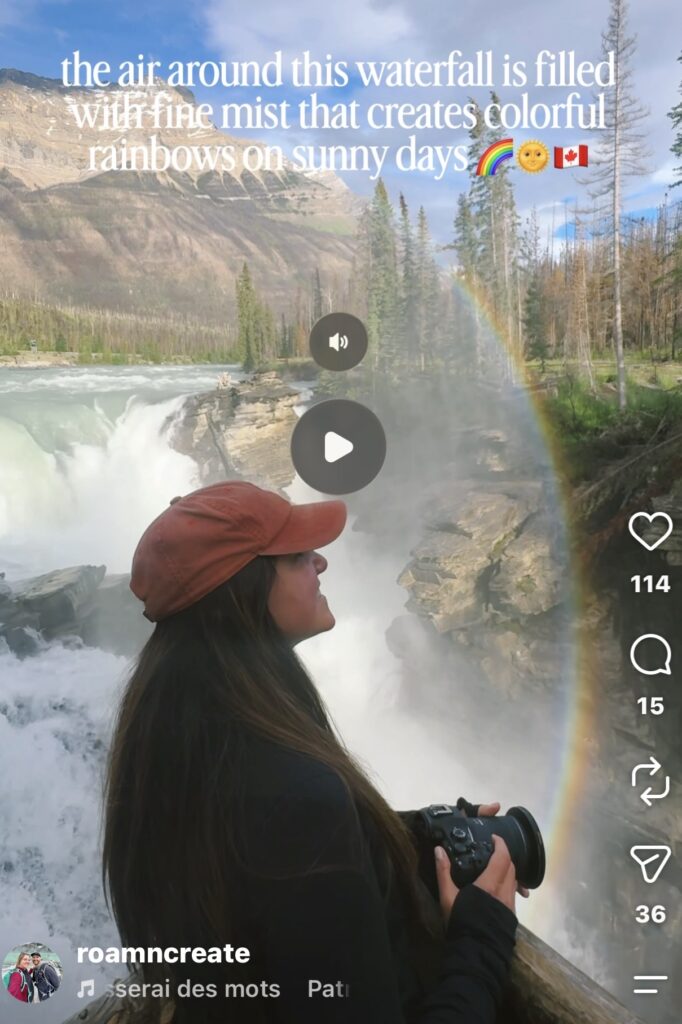
This waterfall doesn’t require any hiking and is one of the main stops on Icefields Parkway tours, which is why it’s always crowded. There are different lookout points, each offering a unique view. The upper loop is easily accessible for all. It takes you to the main viewpoint above the falls and a lower viewpoint farther downstream, where you can feel the spray on your face from the sheer volume of water.
For a different angle, take the lower canyon trail to look up the gorge and see how older waterfalls eroded the surrounding landscape. It will add an extra 15 minutes to your visit.
Athabasca Falls has been shaped by erosion and tectonic activity over millions of years. Even today, it’s still eroding. Geologists estimate that if erosion continues at the same pace, the falls might disappear completely in the next 10,000 years.
Things You Need To Know Before Starting Your Icefields Parkway Road Trip
Here’s a quick but complete rundown of everything you need to know before you set off on this spectacular drive:
🌿 You need a National Park pass for Banff and Jasper that you purchase on the Parks Canada website. You’ll need to show it at the toll gates at each end of the parkway.
⛽ Start with a full tank of gas. There are road signs at each end of the parkway that remind you there’s nowhere to refuel along the route. Technically, there’s one gas station at Saskatchewan Crossing, but you’ll pay a hefty markup, so it’s not ideal. And if they’re out of gas, you’re in trouble.
🏪 Pack your own food and water. There are only a few places to buy food along the parkway, mostly restaurants. If you plan to stop often to hike or explore, it’s a good idea to stock up in Lake Louise or Jasper before you go.
📱 Download an offline map as there is no cell service along the parkway.
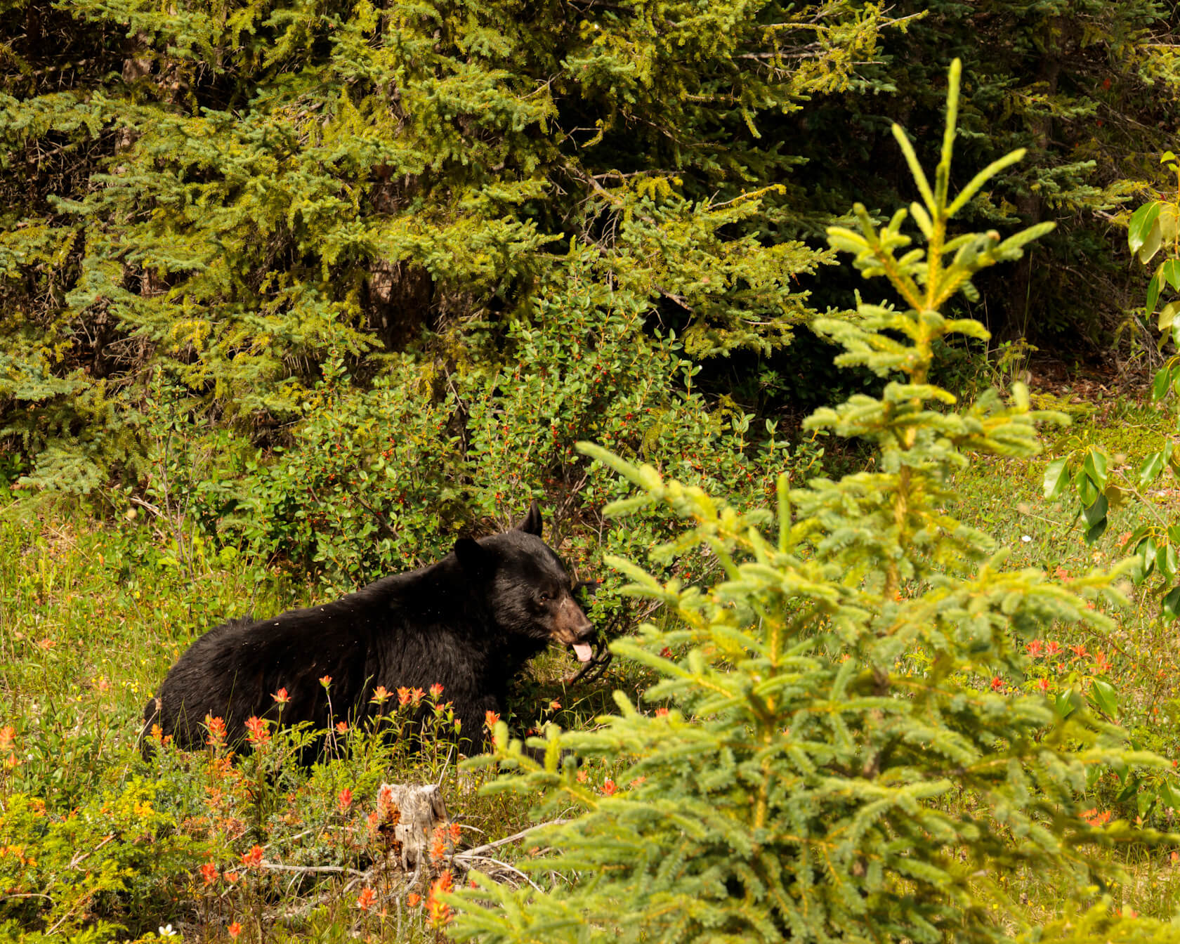
🐻 This is in bear country, so bring bear spray and know how to use it, especially if you plan to hike. If you see a bear by the road, keep moving or pull over carefully. Don’t create a bear jam (it’s a real thing with people stopping their cars in the middle of the highway).
🛣️ The Icefields Parkway is a mountain road, so check driving conditions before heading out. It’s generally fine from May to October, but snow can fall unexpectedly at any time (even in July, as it did in 2026). April through November, conditions are more unpredictable and you’ll need snow tires or chains.
🛶 The blue lakes have their most vivid colors between July and September.
⛰️ You can’t see everything in one day, so decide what interests you the most and plan your trip around those stops instead of trying to do it all.
🏨 Book your accommodation early, and by that we mean 9-12 months ahead, especially if you’re visiting during the summer.
🐝 Driving the Icefields Parkway is one of the most popular activities in the Canadian Rockies, so the main stops are crowded, some more than others. You can get away from the crowds if you hike beyond the main viewpoints, but if you only have one day, it’s hard to avoid the crowds.
🌱 The environment surrounding the Icefields Parkway faces numerous threats, including overcrowding. There are three simple things you can do to reduce your footprint while visiting: stay on designated trails, don’t feed wildlife, and take all your waste with you.
Where to stay along the Icefields Parkway
There aren’t many accommodation options along the Icefields Parkway. It runs through national parks, so that’s to be expected. Most people stay in Banff, Canmore, or Lake Louise, spend the day driving to Jasper, and stay there (or vice versa). But if you wish to explore the parkway for more than a day, there are a handful of options along the parkway, both roofed accommodation and frontcountry campgrounds. Here’s a quick rundown.
Frontcountry Campgrounds
Frontcountry means the campground is accessible by car and within 1 km of a park road or a highway.
You can only camp from roughly mid-June to mid-October, with a few exceptions. Most campgrounds along the parkway are first come, first served. But campgrounds at each end of the drive (in the Banff, Lake Louise, or Jasper area) are reservable.
Competition for campsites is fierce and you’ll need to be online the moment the booking window opens in January. When you log in, you’ll be placed in a queue and wait your turn. You can be 100th in the queue or 40,000th (we’ve experienced both, and the latter was a lost cause because everything was gone by the time it was our turn!). Definitely do a test run through the booking system before that so you can act quickly once it’s your turn. The system isn’t user-friendly, and hesitation or not knowing what to click on could cost you your spot.
You can find info about each campground, including location, fees, types of sites, etc via the Parks Canada links below:
Banff National Park: Camping – Banff National Park
Jasper National Park: Tent and RV camping – Jasper National Park
Some sites are walk-in only, which means you park your car and walk to your site where you set up a tent. Other sites are drive-in, where you can park your vehicle or campervan right at your campsite.
Roofed accommodation
If you’re not into camping, no worries! You can complete this road trip by driving your own vehicle and planning accommodation at either end of the Icefields Parkway or along the way.
Along the Icefields Parkway:
- The Lodge at Bow Lake
- Glacier View Lodge
- The Crossing Resort
- Sunwapta Falls Lodge
In Lake Louise:
- Fairmont Chateau Lake Louise
- Lake Louise Inn
- HI Lake Louise
In Banff, Canmore or Golden: read our guide here.
In Jasper:
- Pine Bungalows (our favourite place to stay in the area)
- Becker’s Chalets
… but Jasper is a town, so there are plenty more options.
Final Thoughts
If you’re lucky enough to spend time in the Canadian Rockies, don’t let the Icefields Parkway slip by. It’s an experience you’ll remember long after.
Please comment below if you have any questions about the stops and we’ll do our best to answer so you can have an epic road trip along the Icefields Parkway.
Did you know that?
By booking through our links, you support us at no extra cost to you. All our info is free to read and ad-free, so thank you! ♥️
Data: install an eSim from Airalo rather than buying a local sim – it’s affordable and much less hassle!
Find a place to say:
- Near Lake Louise: Emerald Lake Lodge – log cabins on the shore of Emerald Lake
- In Banff: Buffalo Mountain Lodge – lodge style accommodation in a peaceful setting
- In Canmore: Malcolm Hotel – luxury accommodation with a rooftop pool
- In Jasper: Pine Bungalows – beautiful log cabins by the river