Golden Ears Peak Hiking and Backpacking Guide

Golden Ears is one of the most iconic day hikes and backpacking destinations in Greater Vancouver.
After moving to Canada, this was one of the first hikes we wanted to try. But with 1,700m of elevation gain and a 24 km round trip, it’s an absolute beast. It took us nearly three years of hiking in British Columbia before we felt ready to take it on, and even then, we knew we wanted to backpack it, rather than do it as a day hike.
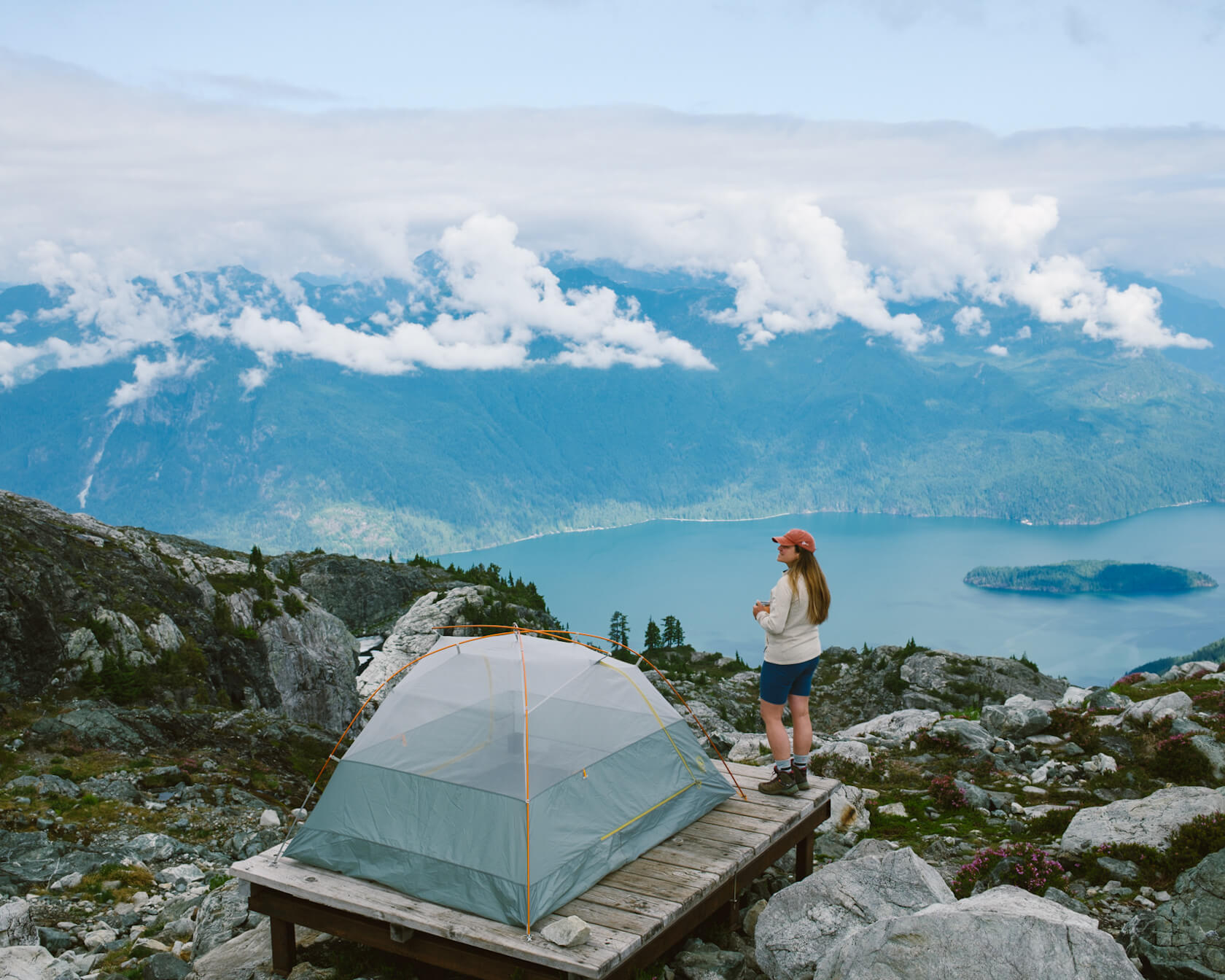
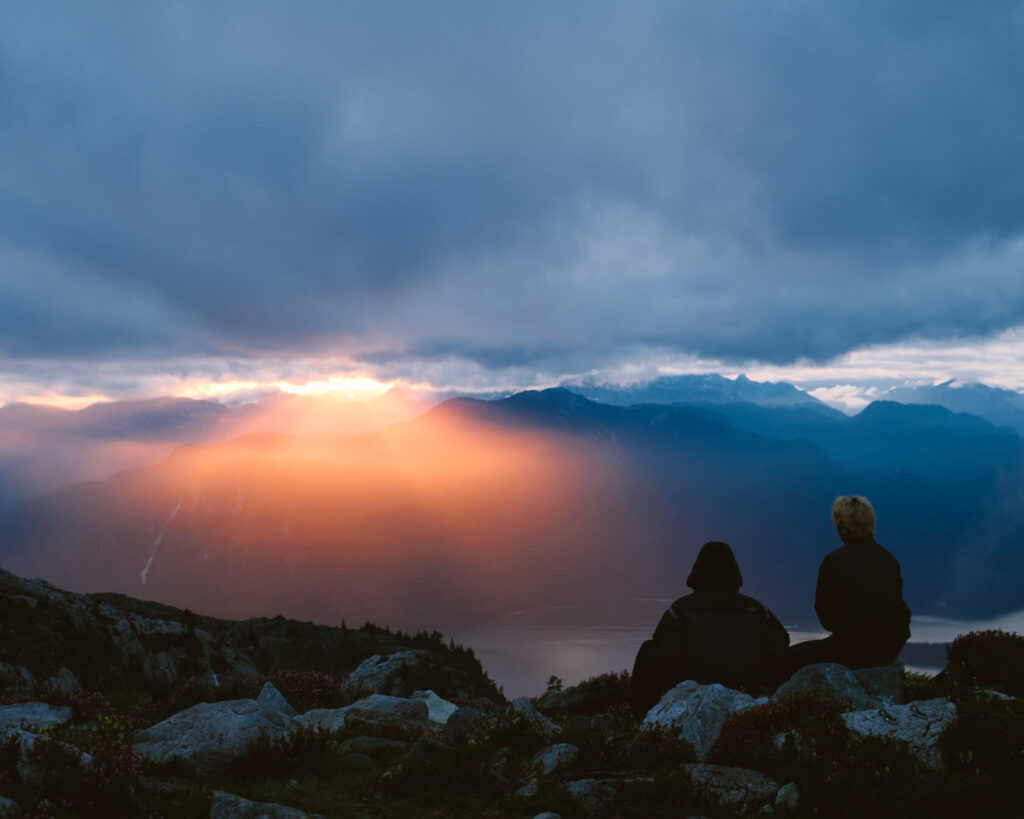
We chose to backpack because it’s not often you get to spend the night on a mountain ridge. In the evening at the Panorama Ridge campground, you can watch the sunset disappear behind the mountain peaks surrounding Pitt Lake. On a clear morning, you wake up to sunrise on the other side of the ridge.
While hiking Golden Ears certainly isn’t for the fainthearted, it’s a great way to challenge yourself and be rewarded with panoramic views of the area.
In this guide, we’ve got everything you need to know about hiking and backpacking the Golden Ears peak, including:
What to know before you hike Golden Ears
Golden Ears Peak is a challenging hike that only experienced hikers should attempt, but one of the best in the Greater Vancouver area for 360-degree views.
Here are some quick tips to keep in mind before you strap on your hiking boots:
- 🚗 The trailhead is only accessible by car.
- 🕛 The gate for Golden Ears Provincial Park is open from 7 am to 11 pm in summer, so the earliest you can start is 7 am.
- 📅 To do this as a day hike, you need a day pass, and to camp at the Panorama Ridge campground, you need a backcountry permit. You can book both on the BC Parks website.
- 🥾 24 km out-and-back with an elevation gain of around 1,700 metres to the summit (22km and 1400 metres out and back to the campground).
- 🥵 Physically difficult hike where you’ll use both your feet and hands (the obstacles keep it fun and interesting though).
- 📱Phone reception is not available on this hike and it’s important to download an offline map such as AllTrails before you go.
- 🐻 Golden Ears Provincial Park is known for black bears, so carry bear spray and know how to behave in an encounter.
- ☀️ The best season to hike is July through September.
- 🦍💨 The only outhouses are at the trailhead, Alder Flats campground and Panorama Ridge campground. They’re typical backcountry outhouses that aren’t cleaned regularly, so definitely bring your own toilet paper and hand sanitizer (and optionally a nose plug).
- 🗑️ Pack out all your trash and leave the trail clean for the next person.
As for what to wear for the Golden Ears hike, we recommend proper hiking boots for the roots and rocks on the trail, especially on the way down. The trail can be muddy and slippery too. But pack comfy shoes in the car to change into when you’re done. Trust us, after 24km of hiking, your feet will thank you.
For our July backpacking trip, we hiked up in short-sleeved tops and waterproof pants with waterproof jackets at the ready. At the campsite, we changed to base layers and a warm Polartec. It turned out to be surprisingly cold at night and we needed extra layers to stay warm. On the way down, we had full sun and hiked in short-sleeved tops and shorts.
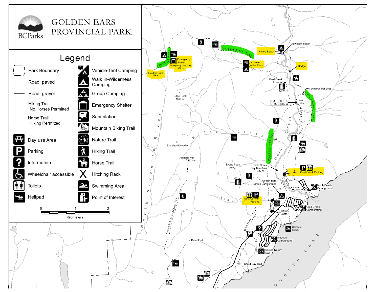
Hiking Route Options For Golden Ears Peak
Currently, the only officially open route is from the Gold Creek Parking Lot via the East Canyon Trail. The other option is to start at the West Canyon Parking Lot and follow the West Canyon Trail, but this trail has been closed for a while due to a washout, so the East Canyon Trail is currently your only option, at least officially.
Both trails are about the same length and join shortly before the Alder Flats campground. From this point on, it’s just one trail to the top. It’s relatively easy to follow all the way to the Panorama Ridge campground, but if you’re planning to reach the summit, you’ll need an offline map. This last section requires a lot of scrambling, but there’s no significant exposure if you stay on the right trail. Problem is, it’s very easy to go the wrong way and get yourself in a tricky spot.
Golden Ears Peak Trail Notes (via the East Canyon)
The trail from the Gold Creek parking lot to Panorama campground is quite well marked, although sometimes the markers aren’t obvious and there may be two or three route options to choose from. This is especially true in the steep forest section past the stairs and once you’re up on the ridge. It’s pretty hard to get lost, but you could end up adding some distance or difficulty to your hike.
The hike starts easy through the forest, following the same route day hikers use to reach Lower and Upper Falls. After around 3.5 km, you’ll turn left to cross the bridge over Gold Creek. Shortly after, you’ll pass the junction for Hiker’s Beach, where some backpackers choose to camp before tackling Golden Ears. From there, the trail becomes more rugged and rocky all the way to Alder Flats.
There are several water sources along this first section of the trail, but the best one is on your right just before Alder Flats. Fill up your water bottles here because there are no other reliable water sources until you reach the Panorama Ridge campground. We used 3 litres of water between the two of us and that was on an overcast day.
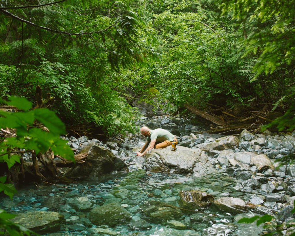
the stream by Alder Flats where you can refill your bottle 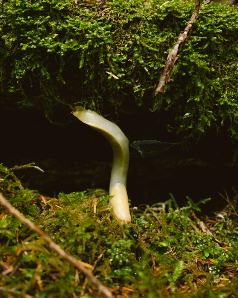
banana slug, the largest slug in BC 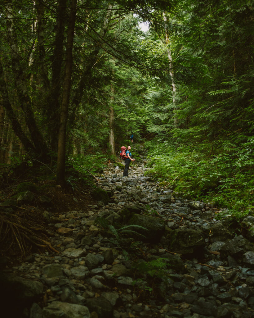
rocky terrain after Alder Flats 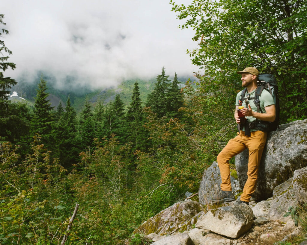
viewpoint after Alder Flats
Alder Flats is approximately the halfway point of the trail, but you’ve gained less than one-third of the total elevation. That means the second half of the hike is much steeper, with around 1,200 vertical metres still to climb. If you want to take a break before this section, there’s a nice viewpoint about 500 metres past the Alder Flats campground.
After Alder Flats, the terrain will slow you down as you walk over large, loose rocks. Then come three steep staircases in a row, all missing the first step. This is your sign that the hardest part of the hike is about to begin.
You’ll continue climbing through the forest on really steep, technical terrain full of roots, loose dirt and even a few ropes you’ll need to pull yourself up with. This part really sucks when you’re carrying a heavy overnight pack. While it’s definitely challenging, it can also be a lot of fun if you enjoy this kind of terrain. We found it just as mentally challenging as it was physically because it feels like you’re constantly going up without actually getting anywhere. We had AllTrails running at first, but eventually stopped checking it because seeing almost no progress was more demoralizing than helpful.


one of the rope sections
Once you’re out of the forest, don’t make the same mistake we did by thinking the hard part is over. The trail now follows a long ridge and becomes more of an up-and-down traverse rather than a continuous climb. However, there are still plenty of technical sections where you’ll need to use your hands to scramble over rocks and pull yourself up by roots.
Eventually, you’ll reach a short wooden ladder. That’s when you know you’re almost there. You’ll still have some climbing to do, but the terrain becomes much easier until you reach the final obstacle: a short but steep boulder field just before the Panorama Ridge campground.
Although most of the hike is through the forest, once you’re on the ridge, you’ll definitely feel the sun. Luckily, the day we hiked Golden Ears, it stayed hidden behind the clouds. On a sunny day, the climb would be much more brutal. We know because the sun came out on our way down and it made the hike noticeably harder. Hiking on a cloudy day also meant we couldn’t really see how far we still had to go, which turned out to be a bit of a blessing.
Reaching the Panorama Ridge Campground
After the final push up the steep boulder field, you’ll reach Panorama campground at 1,380 metres.
Honestly, we were so relieved that the hike was over that we just sat on our tent pad for a while before setting up camp for the night.
The campground itself is beautifully situated. It sits on a narrow ridge with incredible views stretching for miles to both the east and west. This means that, if the weather is on your side, you can watch the sunset from one side of the ridge and wake up to the sunrise on the other. This is about as good as it gets when it comes to backcountry camping.

view from the boulder field towards the campground prime estate spot at Panorama Campground
The only challenge is getting a tent pad. In theory, this should be easy, especially now that camping in Golden Ears requires a backcountry permit. However, this system is brand new as of 2026. In previous years, it was first-come first-served, and considering how popular this hike is, there were often more tents than available spots.
When we visited in July 2026, we arrived with a permit and got a tent pad, but it was the last one available. There were still more tents than platforms, and we know of at least three pads that people occupied without permits. One couple knew about the new system but decided to take their chances anyway. We’re not sure if the other two couples knew about the change. Since this is still a new system and there is no signage at the trailhead explaining the new rules, it’s possible some people simply aren’t aware. Hopefully, this improves in 2027.
The campground has 6 wooden tent platforms, one much smaller and more weathered platform that is nearing the end of its life, and one concrete pad. For those who don’t have a pad, some people set up before the boulder field and others on the ledge above the campground.

alpine wildflowers at the Panorama Ridge campground 
one of the undesignated pads before the campsite
There’s an outhouse and an emergency shelter, both in the same building. Neither is particularly nice, but after all, you’re deep in the backcountry and they do the job.
The emergency shelter also doubles as the bear cache, as there are no other options for storing food and no suitable trees for a bear hang.
Just make sure you hang your food bag on one of the hooks, as quite a few mice are living in the shelter. I know some people are afraid of these harmless little furballs, but in many cases that fear is something we learn from how they’re portrayed. They’re simply part of the ecosystem here and just going about their lives while we’re passing through. Once you look at them that way, it’s hard not to admire their amazing ability to survive.
One last thing to know: there is no dependable water source at the Panorama Ridge campground. When we were there in July, there was a clear waterfall spring next to the shelter. It’s runoff from the snow on the peaks above and we read in multiple places that it can dry out later in the summer.

Emergency shelter at Panorama campground 
water source at Panorama Campground
Summitting Golden Ears Peak
Our objective was always to make it to the summit of Golden Ears, but it just wasn’t in the cards this time. By the time we reached the campground, we were completely wiped out, and climbing another 1 km with 300 metres of elevation gain was the last thing we wanted to do.
The weather wasn’t great anyway, with clouds hugging the summit all afternoon and evening, so we felt in a way the universe was giving us an out and we were happy to take it. We really didn’t want to make the extra effort unless there were a chance the views would clear.
We thought we might try again in the morning, and Andy even got up for sunrise, only to find clouds still covering the summit. Overall, it never properly cleared while we were there. It only started to open up as we were making our way back down, which was too late.
We still want to come back and finish what we started, but it will probably be as a day hike rather than another overnighter!

Views from the campground on Day 1 
Views from the campground on Day 2
Before this trip, a friend who had done the summit told us the route is technical and involves a lot of scrambling. She also said we need an offline map and if we found ourselves on exposed terrain, it meant we were off the trail. So we’ll leave you with the same advice: make sure you have an offline map and don’t underestimate the route.
A Few Notes About Alder Flats and Hiker’s Beach Campgrounds
Some people choose to split the hike up by spending one night at Alder Flats or Hiker’s Beach.
Alder Flats is located in the forest and has 10 tent pads, a bear cache and an outhouse that leaves a lot to be desired. There is also a great water source just before the campground.

trail marker at Alder Flats 
typical tent spot at Alder Flats
Hiker’s Beach is located on a pebble beach by the river. It has 20 tent pads and a bear cache.
Some people choose to stay at one of these campgrounds and do the Golden Ears summit as a day hike. As we mentioned earlier, it’s really after Alder Flats that this hike becomes much harder and more technical, so tackling that section without an overnight pack definitely makes things easier.
The downside is that you’ll miss sunrise and sunset at the ridge. For us, those moments were the priority.


Backpacking Golden Ears Peak Wrap Up
Overall, Golden Ears is a fantastic backpacking trip that’s only 1.5 hours from Vancouver. The climb is demanding, but the payoff at the end is huge. If you want a good challenge, minimum driving and maximum views, then you’ll love Golden Ears!
Looking for even more hikes in Vancouver? Read our other BC hiking guides.